
Lindenwold Neighbors by Block Source
Different Lindenwold records answer different block questions. The GIS viewer maps the nearby parcels. The assessment hub gives current assessment details for a selected parcel. The Clerk’s index documents a recorded relationship to the land. Civic resources describe public groups, not a neighborhood roster. New Jersey voter systems are designed for individual registration status and election administration, not for publishing a casual block list. Read the return from each channel at that narrow level.
| Source | What It Shows About a Block | Access |
|---|---|---|
| Camden County GIS | Adjacent parcel set, property-card route, and a 200-foot report | Online viewer with PDF and Excel report options |
| Assessment Search Hub | Assessed owner, property, block-lot-qualifier, class, and sales fields | Online, with date stamp and download control |
| Camden Clerk index | Recorded deed, mortgage, discharge, cancellation, or other indexed instrument | Online from 1978; archive routes for earlier records |
| Lindenwold civic inventory | Public boards, committees, contacts, agendas, and meeting information | Official Borough resource |
| Voter administration | Individual registration and releasable election-record procedures | State portal and Camden election office, subject to limits |
A property owner is not automatically an occupant. A radius report is not a legal boundary survey. A voter record is not a public block directory. Those distinctions keep a Lindenwold neighbor search useful without turning public fragments into a claim about every person around an address.
Note: Save the report date and chosen radius because parcel and assessment results can change after a later update.
Locate Lindenwold Neighbors in GIS
The Camden County GIS Viewer is the practical first screen for Lindenwold neighbors. It supports Address Search, Street Search, Owner Search, PIN Search, Block/Lot Search, and map selection. A selected parcel can produce a Parcel Profile Report or Property Card. The viewer also offers a list of properties within 200 feet and mailing-label tools, with PDF or Excel report options. The 200-foot function is a spatial list of nearby parcels, not an occupant list or a finding that every parcel shares a boundary.
Confirm the exact situs line before expanding the map. Parcel systems separate a property’s physical location from the owner mailing address. Keep the municipal code, block, lot, qualifier, and PIN as they appear. The report helps identify where the next property record begins, while the assessment and Clerk systems provide the supporting context for each selected Lindenwold parcel.
- PIN
- A parcel identification key used by the GIS system. It is useful for matching map selections to property records.
- Block / lot / qualifier
- The parcel components used in local property records. They can be more stable than an abbreviated street line.
- Radius report
- A list of parcels within a set distance from the selected parcel. It is a proximity tool, not a statement of occupancy or ownership rights.
Map a Lindenwold Block by Parcel
A reliable Lindenwold block workflow keeps the map, assessment data, and recorded instruments in separate columns. Start with one property rather than broad name searching. Each result should retain its source and date, since a property profile, assessment record, and deed do not necessarily update at the same time.
- Enter the starting Lindenwold address in GIS, then select the parcel and record its address, PIN, and block/lot details.
- Run the 200-foot property list or review the surrounding map parcels. Keep the radius and report date with the results.
- Open each neighboring parcel in the Camden County Property Assessment Search Hub to compare its displayed property and assessment information.
- Where a transfer or boundary question matters, check the recorded-document chain and legal description for that individual parcel.
- Use the full Lindenwold street directory process only when the question expands from the immediate block to a whole named street.
The flow is address to parcel, parcel to nearby parcels, nearby parcel to assessment context, then assessment context to recorded-document review. It is more dependable than inferring Lindenwold neighbors from a loose street-name match.
Lindenwold Neighbors and Parcel Owners
The assessment hub provides an independent check after a GIS selection. Its visible search fields include Town Filter, Owner Name, Property, B.L.Q. Filter, Class Filter, sales date and price ranges, building-square-footage range, and year-built range. The page documents an asterisk for truncation and a question mark for one-character matching, displays an import date, and includes a download-limit notice. It does not make a search result a current-residence determination.
For a recorded history, use the Camden County Clerk online-property records. The online index covers 1978 to the present and is updated nightly. Basic access is free and prints with an unofficial watermark; Premium access has broader categories. A deed may carry grantor, grantee, dates, legal description, consideration, and other recorded fields. Compare those details to the selected Lindenwold parcel, not to a guessed household.
The Clerk index does not expose every historical document online. Earlier deeds lead to the State Archives and CCHS, while a current owner mailing address may be outside Lindenwold. Use those limits when describing what the record proves.
Note: Assessment and deed dates may differ, so preserve both dates before describing a Lindenwold parcel relationship.
Lindenwold Civic Groups Near a Block
No separate official Lindenwold neighborhood-association or block-club directory was located. The Borough’s Boards & Committees inventory is the accurate public community layer. It lists civic bodies with public-facing purposes, meeting material, or contact paths. These are not household rosters, and the research does not support presenting them as neighborhood associations.
Borough Council
Municipal governing body and official civic contact route for borough-wide matters.
Friends of the Library
Library-support group connected to Lindenwold’s public library and local-history resources.
Joint Land Use Board
Public land-use body relevant to parcel and development questions, not a resident directory.
Library Advisory Board
Public advisory body for library matters and an appropriate route for collection questions.
Parks & Recreation Commission
Civic group for public recreation matters and community programming.
Public Events Committee
Borough civic group for community-event information and public notices.
The official Borough committee page is the source for the civic inventory shown here.
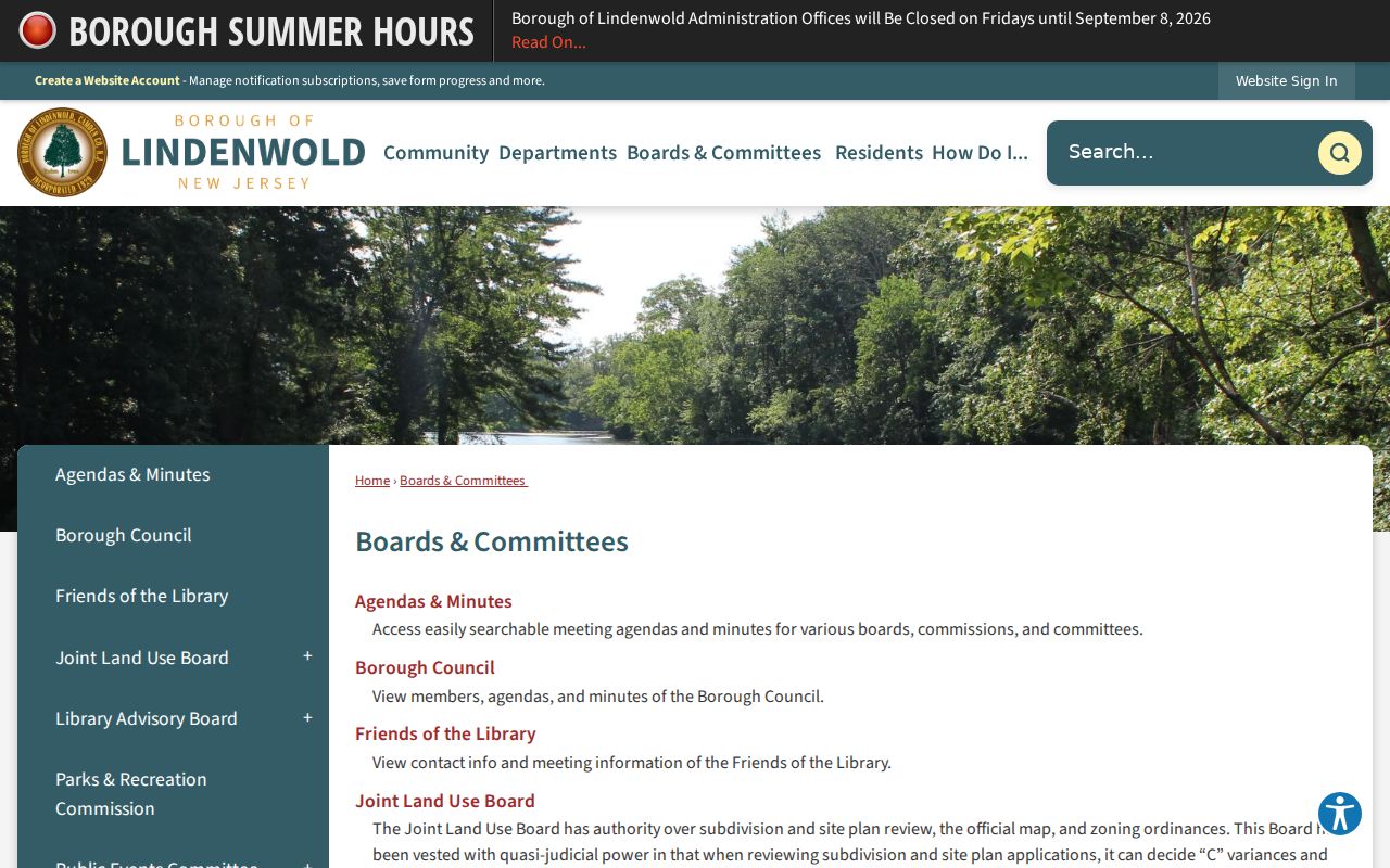
The Borough inventory helps a Lindenwold neighbor search reach public community information without treating civic participation as evidence that a person lives on a particular block.
Lindenwold Neighbor Tools Compared
Official parcel records and commercial neighbor tools serve different purposes. A commercial category may blend public filings, marketing data, historical addresses, phone associations, and inferred household connections. Those products can be stale, duplicate people with the same name, and confuse a parcel owner with an occupant. Their presentation should not replace a current Lindenwold record from the relevant custodian.
| Official parcel route | Shows a defined source, record date, and specific parcel or instrument context. It still has coverage and update limits. |
|---|---|
| Commercial category | May combine sources and estimates. Matching, timing, address association, and opt-out handling can vary. |
| Best use | Return to GIS, assessment, Clerk, or a public office to verify the item that matters before relying on it. |
Note: A result without a source date or parcel identifier is a lead to verify, not a dependable Lindenwold block finding.
Lindenwold Block Record Requests
Some address evidence is not a searchable portal. Lindenwold’s residential CCO process addresses open permits, unpermitted work, unsafe conditions, and property compliance in a sale or transfer. The municipal code describes permit applications, issued permits, plans, reports, complaints, and actions held by the building inspector. No public online Lindenwold permit or code-case index was found. A targeted request is the correct next step when an address-specific municipal file matters.
Call Borough Hall at 856-783-2121 for the department route, or use the Borough’s OPRA request form. State the address, parcel details if known, record type, date range, and delivery preference. OPRA requests are written, signed, and dated, and a custodian may segregate releasable public material from protected information. Do not request more personal detail than the block question requires.
For older block context, use the library reference desk at 856-784-5602, the CCHS appointment and research-request channel at 856-964-3333, and the State Archives. The public access routes are intentionally redundant: online map and assessment tools for current parcel work, office and request channels for municipal files, and library or archive research for history.
Lindenwold Neighbors Across Boundaries
A Lindenwold street or mailing line can sit near another municipal boundary. Official borough material lists Berlin Borough and Township, Clementon, Gibbsboro, Gloucester Township, Laurel Springs, Pine Hill, Somerdale, Stratford, and Voorhees as bordering municipalities. That geography makes it important to retain the borough and Camden County fields even when a map label looks familiar.
The confirmed Lindenwold ZIP is 08021, but USPS explains that ZIP boundaries do not necessarily follow municipal lines. Use the USPS ZIP Code Lookup to validate delivery spelling and units. Its result does not confirm who lives at an address. A ZIP is a delivery clue, while the GIS parcel and assessment record provide the Lindenwold property context.
Note: Keep a street address, borough name, ZIP, and parcel identifier as separate fields when comparing a border-area Lindenwold result.
Lindenwold Neighbor Privacy Limits
Public records are open in layers, not as permission to assemble a private block dossier. Parcel and deed sources may show a property relationship. They do not provide a complete list of renters, household members, utility users, or personal relationships. The state registration check is limited, and no public block-level voter directory was located in the inspected portal. Any statutory registry-list request has its own rules and protected-field limits.
New Jersey’s Address Confidentiality Program and Daniel’s Law can protect address and related information for eligible or covered people. Request only the records needed for a real civic, property, family-history, or safety question. Do not copy protected fields from an official screen, and ask the custodian about redaction when a file mixes public and protected information.
Lawful personal use. Lindenwold neighbor research can help with property curiosity, civic awareness, and reconnecting through appropriate public channels. Never use records to watch, harass, intimidate, or harm anyone.