
Lindenwold ZIP Code Directory Coverage
Official Lindenwold material uses ZIP Code 08021. The inspected borough and USPS sources confirmed that code, but did not expose a second current ZIP or a complete current list of accepted alternate locality names. The ZIP code directory therefore separates the confirmed current code from a historical postal reference rather than inventing coverage for neighboring communities. Validate any individual delivery address with USPS before treating a ZIP label as current.
| ZIP | Area observed | Post-office fact | Directory treatment |
|---|---|---|---|
| 08021 | Lindenwold, New Jersey, as used on official Borough pages | USPS retained the Lindenwold place name and ZIP after the former branch classification changed in 2011 | Confirmed current Lindenwold ZIP; validate a delivery line live |
| 08021, historical label | Former Clementon branch reference | The Postal Bulletin describes a former branch classification, not a second current borough ZIP | Historical context only; do not normalize a modern parcel to Clementon without USPS confirmation |
No inspected official source supplied a complete alternate-city crosswalk for 08021. ZIP service areas can cross municipal borders, so a code can narrow a search but cannot replace the borough, street number, unit, or Camden County parcel fields.
Lindenwold ZIP Search Fields
The official USPS address lookup has three distinct modes. “By Address” checks a delivery line. “By City and State” starts with a locality. “Cities by ZIP” starts with the code. The service warns that a result does not confirm a person or company. When several address matches appear, add the apartment, suite, or other detail before trying a parcel system.
| USPS mode | Fields documented | Use in Lindenwold research |
|---|---|---|
| By Address | Optional company; required street address; optional apartment, suite, or other; required city and state; optional ZIP | Validate a full delivery line before matching a parcel. |
| By City and State | City and state | Check postal locality spelling without assuming municipal boundaries. |
| Cities by ZIP | ZIP | Check the postal locality output, then retain borough and county as separate fields. |
The USPS lookup page is the source for these delivery-validation modes.
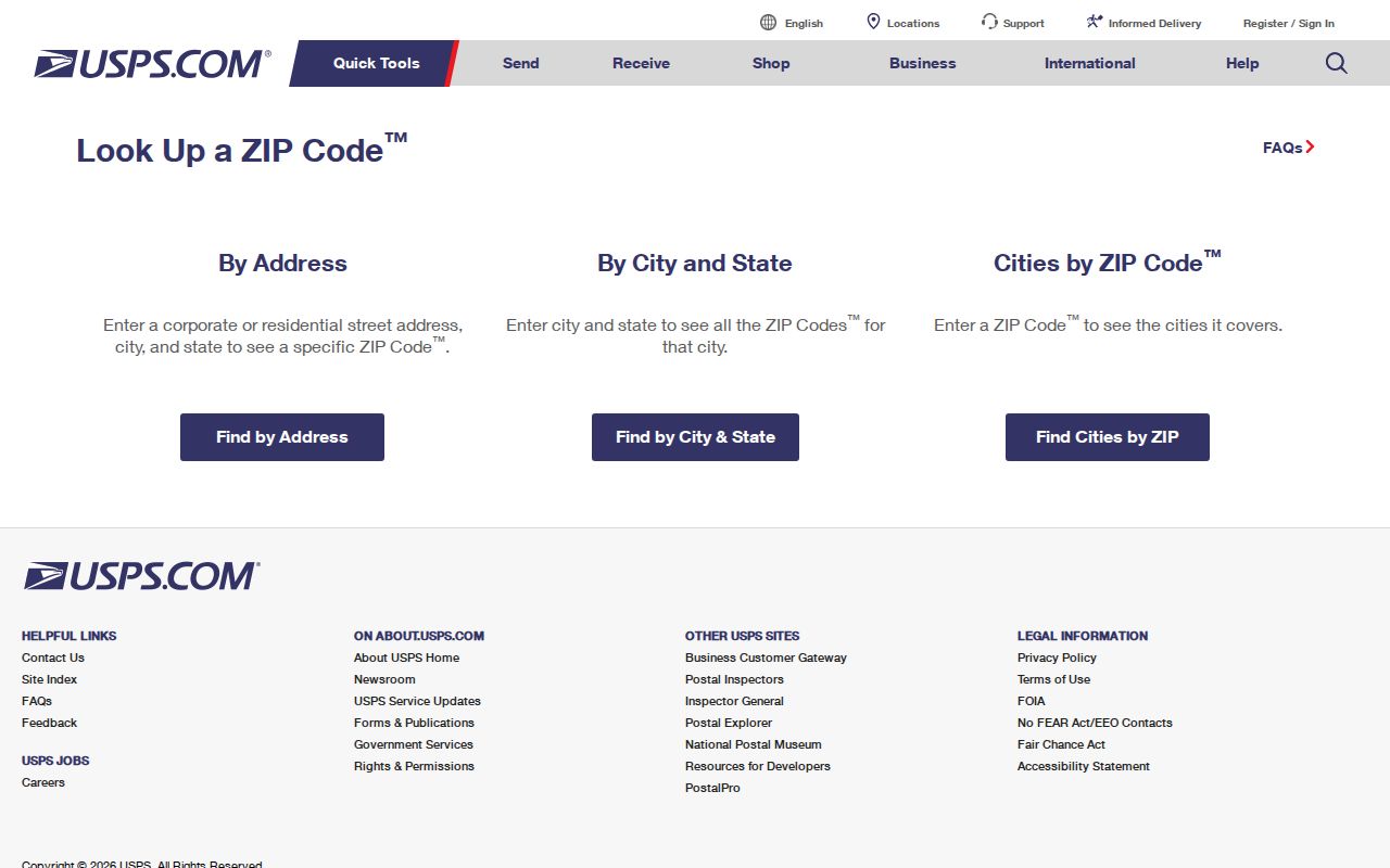
Its result is a delivery check, not a resident finding. Keep it beside the parcel and source date rather than using it as identity evidence.
Lindenwold ZIP Lookup Steps
A ZIP-wide public resident roll was not identified in the inspected Lindenwold sources. The defensible approach is address-first, then parcel-first. New Jersey's public voter portal is an individual registration-status tool, not a ZIP bulk directory. The Camden assessment hub has property and B.L.Q. search fields, but the inspected interface did not show a dedicated ZIP filter. Do not imply that either system returns everyone in 08021.
- Run the complete address through USPS and save the returned city, state, ZIP, and unit formatting.
- Search the Camden County GIS Viewer by address or street. Record block, lot, qualifier, or PIN from the selected parcel.
- Compare the address or B.L.Q. result in the Camden County Property Assessment Search Hub, preserving its import date and owner-versus-situs distinction.
- Use the parcel and current recorded party only when a deed, permit, or other dated record is needed. For older address history, use the county library, CCHS, or State Archives route.
Once a ZIP result has narrowed the right delivery line, the Lindenwold street directory provides the fuller address-by-address record trail.
Lindenwold ZIP Parcel Context
Camden GIS and the assessment hub help reconcile a postal address with a public parcel record. GIS supports Address Search, Street Search, Owner Search, Block/Lot Search, PIN Search, and map selection. The assessment hub exposes Town Filter, Owner Name, Property, B.L.Q. Filter, class, sales, square-footage, and year-built fields, plus sorting and Excel download controls. The hub documents * truncation and ? as a one-character match; it also displays a download-limit notice.
Neither output should be reduced to the ZIP alone. Preserve municipality, block, lot, qualifier, PIN, situs or property field, assessment owner display, and source date. A mailing address can be elsewhere, and a mapped parcel is not a survey. For a recorded interest, the Camden County Clerk online index reaches 1978 to the present and is updated nightly, while older deed work uses State Archives and historical collections.
Note: When a postal result and parcel record appear to conflict, retain both exact strings and ask the municipal assessor about an address correction rather than guessing which one changed.
Lindenwold Postal Boundaries
USPS explains that ZIP boundaries do not necessarily match city, borough, or municipal boundaries. Lindenwold's geography reinforces that caution: official material describes borders with Berlin Borough and Township, Clementon, Gibbsboro, Gloucester Township, Laurel Springs, Pine Hill, Somerdale, Stratford, and Voorhees. A nearby address may share a postal service area while belonging to another municipality and a different local record custodian. Use county and parcel details to determine the appropriate office.
- ZIP
- A five-digit postal routing code used to help deliver mail. It is not a municipal boundary or a resident list.
- ZIP+4
- An added four digits that can narrow delivery routing below the five-digit ZIP level.
- PO-box ZIP
- A code associated with post-office boxes rather than a claim that every nearby street uses the same delivery route.
- Unique ZIP
- A ZIP used for a single organization or facility. No such Lindenwold code was confirmed in the inspected material.
- Carrier route
- A postal delivery grouping. It can help address-quality work but does not show residents.
Because the alternate-locality list was not exposed, a live USPS or AIS result is the right check before publishing a city-name crosswalk for 08021.
Lindenwold ZIP+4 AIS Details
The USPS AIS Viewer describes address-quality data that can report city, state, delivery type, county name, delivery statistics, ZIP+4, carrier route, delivery point, and check digit. Its public description says the product is updated monthly. Address Lookup is free when paired with another product, while the exact current public access arrangement was not exposed on the inspected page. Treat it as an address-quality resource, not a person search.
The AIS Viewer description outlines the ZIP+4 and county fields available through the product.
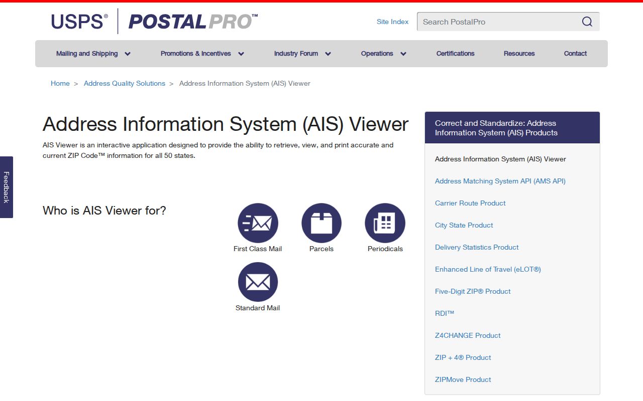
A county field is useful when a postal label alone creates doubt. The final parcel match still belongs in Camden GIS and the assessment record.
Lindenwold Postal History
The 08021 postal history has a useful local wrinkle. A 2011 USPS Postal Bulletin says the Lindenwold office had formerly been classified as a branch in Clementon. The branch was discontinued on January 28, 2011, while the Lindenwold place name and 08021 ZIP were retained. That is a postal classification detail, not proof of a second modern ZIP for the borough.
Postal-history tip. If an older document uses a Clementon branch reference, verify the full street address and the document date before assigning its parcel to present-day Lindenwold.
The history explains why a historic mailing label needs both a date and an exact address. It should not override a current USPS result, municipal record, or Camden parcel identifier.
Lindenwold ZIP Access Routes
Online validation begins with USPS, AIS, Camden GIS, and the assessment hub. For a particular parcel, the Camden County Clerk supplies the recorded-document index from 1978 forward. The local assessor handles written address and name corrections; the official county contact list places the Lindenwold assessor at 15 North White Horse Pike and lists 856-783-2121. A staff member can confirm current routing for a data correction or a parcel question before an in-person visit.
When there is no online record, use the access channel that holds the record. Lindenwold Construction and Code Enforcement handles address-keyed permit or certificate questions, with a focused written request under the Open Public Records Act for releasable municipal material. The County Clerk can be reached at 856-225-5300 for recorded-document routing. For older directories, maps, deeds, and newspapers, the Camden County Library, CCHS at 856-964-3333, and State Archives provide the historical path. CCHS research requests and office-specific written requests are the mail or email fallbacks.
Bring the complete delivery address, borough, county, ZIP, and any known block and lot to an office counter or phone call. A postal code alone is too broad for a permit, deed, or assessment question. The library can provide computer access when a resident needs a public portal, while CCHS research staff can help route a dated collection request. For an OPRA request, name the record type and date span, then ask the custodian to release separable public material where a file also contains protected details. That precise request is more likely to reach the correct Lindenwold record than a broad demand for every address record in a ZIP.
Lindenwold ZIP Directory Limits
The Lindenwold ZIP directory can validate a delivery route and guide a parcel search. It cannot verify who lives at an address, establish ownership, or identify everyone served by a code. USPS itself warns that a result does not confirm a person or company. Assessment data can reflect an owner relationship, GIS describes a parcel, and a deed records an instrument. Each has its own date and scope.
Use only the amount of public information needed for a personal, lawful question. Keep protected identifiers out of any combined notes, confirm important records with the custodian, and never use ZIP, parcel, or address results to stalk, harass, intimidate, or harm anyone.