
Walking a Lindenwold Street Directory
A street-by-street search begins with the address itself, not a surname. Use the official USPS ZIP Code Lookup to check the delivery line and any unit before opening county records. Next, locate the parcel in Camden GIS and compare its block, lot, qualifier, or PIN with the assessment record. The owner shown for assessment purposes may receive mail elsewhere, so it should not be treated as proof that the owner lives at the property. The Clerk index then supplies a dated recorded-interest trail. Older directories and archive material can add dated street context once the modern chain is clear.
- Validate the number, street name, suffix, unit, city, state, and ZIP through USPS. Keep the returned delivery line with the date checked.
- Search the Camden County GIS Viewer by address or street, then record the parcel identifiers from the selected result.
- Compare the same parcel in the Camden County Property Assessment Search Hub. Preserve the owner display, property field, class, and data-import date.
- Use the current owner and legal description as search seeds in the Camden County Clerk recorded-document search. Follow grantor and grantee names backward while checking the parcel description.
- When online records stop, inspect library, historical society, and State Archives routes for dated directories, maps, newspapers, and older deeds.
That order avoids joining a current delivery address to an old recorded name without checking the parcel or date. A result can document an assessed or recorded relationship. It cannot automatically establish every person who stays there.
Note: Preserve the source name and access date beside every Lindenwold street result so later checks can distinguish a newer update from an older record.
Lindenwold Street Addresses and ZIP
USPS treats the delivery line as a postal question. Its address mode uses a required street address, required city and state, an optional company field, optional apartment or suite detail, and an optional ZIP. The result helps test deliverability and locality spelling. It does not identify a person or company, and a multiple-match result calls for more unit detail. Lindenwold uses 08021 on official borough material, but a ZIP line is not a replacement for a municipality, county, or parcel identifier.
- Situs address
- The physical parcel location used in assessment and mapping records. It may differ from where an owner receives mail.
- Parcel
- A mapped piece of land identified by fields such as block, lot, qualifier, or PIN. It connects maps, assessment data, and legal descriptions.
- Plat
- A recorded map that depicts lots, streets, or boundaries. A GIS display is useful context but is not a survey.
- Criss-cross directory
- A reverse-style directory arranged by address, used to locate a dated listing at a street number when the volume covers that locality.
Keep the ZIP result in one field while borough name and parcel number stay in others. That separation makes a Lindenwold street directory search easier to audit when a deed shows an older locality label or an owner mailing address outside the borough.
Lindenwold Street Parcels in GIS
The GIS viewer is the map-validation layer for a Lindenwold address search. It supports Address Search, Street Search, Owner Search, Block/Lot Search, PIN Search, and selection from the map. A selected parcel can produce a Parcel Profile Report or Property Card, and the viewer can export reports as PDF or Excel. Search a full street only after confirming the suffix, then select individual parcels when a street result contains similarly named roads or multiple units.
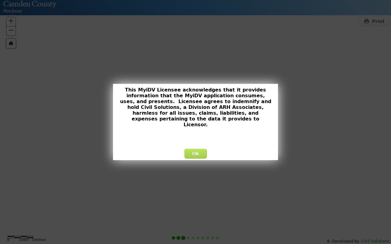
The Camden GIS Viewer shows the parcel tools used for Lindenwold street research.
Use the selected parcel's identifiers and report date when moving from the map to assessment or deed records. The viewer's map measurement is not a legal survey, and a parcel profile does not identify occupants.
Lindenwold Street Assessment Filters
The assessment hub is an owner-and-property search, not an occupancy roll. Its visible fields are Town Filter, Owner Name, Property, B.L.Q. Filter, Class Filter, Class4 Filter, Sales Date Filter, Sales Price Range Filter, Building Sqft. Range Filter, and Year Built Range Filter. It also provides sort controls and an Excel download control. The inspected page does not state which fields are required, so a careful search should not assume an unmarked filter is mandatory.
| Assessment field | Street-search use | Format note |
|---|---|---|
| Town Filter | Limits a result set to the relevant municipality. | Required status was not stated on the inspected page. |
| Property | Tests an address-style property entry. | Keep exact suffix and unit detail elsewhere for comparison. |
| Owner Name | Compares a displayed assessed owner with a parcel. | It is not occupancy confirmation. |
| B.L.Q. Filter | Matches block, lot, and qualifier information. | Useful when a street line is abbreviated. |
| Class, sales, size, year built | Narrows parcels by assessment attributes. | * truncates and ? matches one character. |
The assessment hub displays a 2026-08-28 data-import date and a download-limit notice.
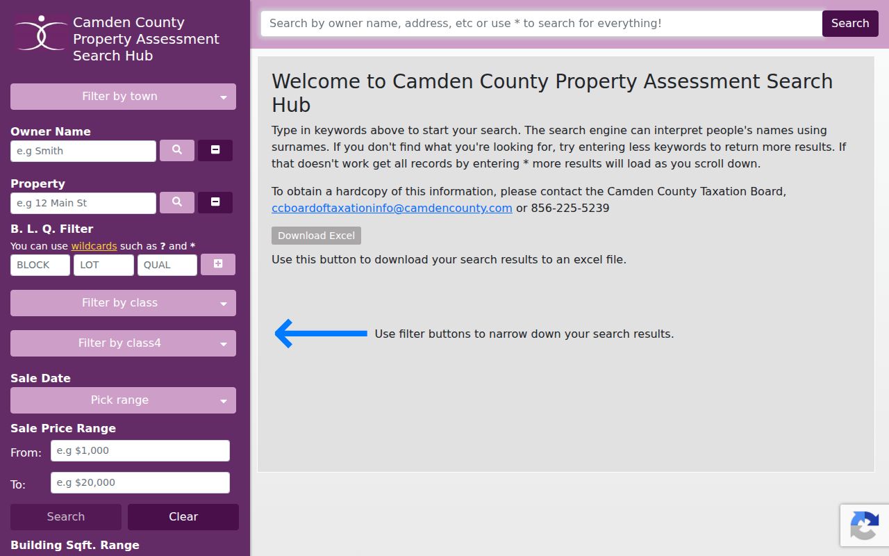
Save that import date with the owner and property result. Address and name corrections route through the municipal assessor by written request, rather than through the county search screen.
Lindenwold Street Directory Records
Each address-keyed source answers a narrower question. Assessment data ties a displayed owner to a parcel. GIS adds geometry and nearby-parcel tools. The Clerk indexes recorded instruments. Construction files can document work or inspections at an address, but no public online Lindenwold permit index was found. Historic collections may supply a dated name-and-street reference when a volume covers the borough. Treat the source type as part of the result.
| Address record | Custodian | Street evidence | Access route |
|---|---|---|---|
| Assessment parcel | Camden assessment hub and Lindenwold assessor | Owner display, property field, B.L.Q., class, sales, size, and year built | Online; written municipal route for changes |
| Parcel map and reports | Camden County GIS | Address, street, owner search, PIN, block/lot, geometry, and 200-foot report | Online PDF or Excel reports |
| Recorded instruments | Camden County Clerk Registry Division | Grantor, grantee, instrument dates, legal description, and recorded interest | Online from 1978, then Clerk, Archives, or CCHS |
| Construction and CCO files | Lindenwold Construction and Code Enforcement | Permits, plans, inspection records, complaints, and actions when releasable | Borough office or focused OPRA request |
| Historic directory and newspaper leads | Camden County Library and CCHS | Dated street, household, newspaper, and map references | Microfilm, appointment, or research request |
A current parcel row, a deed, and a historic directory entry can all refer to the same street number at different times. Keep them in date order. Do not flatten them into one present-day result.
Lindenwold Street Deeds Since 1978
The Camden County Clerk's online property-records route covers 1978 to the present and is updated nightly. Basic access is free, needs no account, permits unlimited printing, and adds an unofficial watermark to printed images. Premium registration costs $25 per month, removes the watermark, and adds categories that include broader liens, lis pendens, municipal and construction liens, trade names, and powers of attorney. Both paths are recorded-document tools, not a list of current occupants.
Start with the current assessed owner and parcel number. Search the Clerk's grantor and grantee trail in both directions, comparing legal description, block and lot, deed date, recording date, deed type, consideration, and returned document identifier. A seller in one record often becomes the earlier buyer in the preceding record. Name variations matter, especially a middle initial or different spelling.
When the online cutoff is reached, the New Jersey State Archives Camden deeds guide covers deeds from 1844 to 1900 and indexes through 1912. The Camden County Historical Society research library also describes original deeds, mortgages, maps, and related research collections. Those channels are needed for an older Lindenwold address trail.
Note: A deed mailing address may be outside Lindenwold, so compare it with the situs and legal description before connecting a party to the street.
Lindenwold Street Permit Requests
Building records can explain a changed structure or an address question that a parcel page cannot. Lindenwold's residential certificate-of-continuing-occupancy form addresses open permits, unpermitted work, and unsafe conditions. The municipal code describes permit applications, issued permits, plans, monthly reports, complaints, and actions held by the building inspector. No public online search index was located for those files.
The fallback is a focused request to the right custodian. At Borough Hall, ask the assessor, construction, or clerk office about the current routing for an address record. A written request under the New Jersey Open Public Records Act should identify the street number, street name, known block/lot, record type, and date range. It can ask for releasable portions to be separated if a record contains protected material. Lindenwold's general municipal telephone is 856-783-2121; confirm current department hours before an in-person visit.
Lindenwold Street Directory History
Older street work needs a different route. The Camden County Library genealogy resources describe county city-directory reels, Courier Post microfilm, and obituary searching. The directory reels span 1863 to 1947 with listed gaps, including 1918-19 and 1932-39. Check a reel's title page and locality coverage before treating it as a Lindenwold criss-cross directory. CCHS describes a longer directory and telephone-book collection, but exact Lindenwold runs were not confirmed in the inspected material.
Lindenwold formed in 1929. The first official borough meeting took place at the old fire hall at Linden Avenue and Berlin Road. That fact can help date local-history research, but it does not create an old/new street-number conversion. No official borough-wide renumbering table or address crosswalk was found. Preserve cross streets, parcel identifiers, legal description, and historic locality wording, then ask the assessor, Borough Clerk, or GIS custodian whether an old/new index exists.
The historical volumes themselves belong with the Lindenwold city directories collection, where dates and collection limits can be checked before using a name-and-address lead.
Lindenwold Street GIS Insider Tip
For a short Lindenwold street search, the GIS viewer can list properties within 200 feet of a selected parcel and generate mailing-label or property-card reports. That is a practical way to compare adjacent parcels without guessing from a map. Preserve the selected parcel, radius, report date, and each returned parcel identifier.
Insider tip. Use the 200-foot report as a parcel-adjacency tool, then compare each result in assessment and deed records. It does not prove who occupies a property or establish a personal relationship.
The report is useful when street names repeat, an address is near a municipal edge, or a legal description needs a nearby-parcel check. It remains a map-generated snapshot, so keep its export date with the Lindenwold street result.
Lindenwold Street Directory Limits
Lindenwold address-record research can show public parcel and instrument relationships, but it cannot supply a complete list of everyone at an address. Assessment ownership may lag a sale. Owner mailing addresses can be elsewhere. USPS validates delivery, not identity. GIS's nearby-parcel feature is a radius report, not a household roster. The state voter portal is an individual registration-status tool, not a public block-by-block directory, and protected information remains outside a routine search.
Use the minimum information needed for a personal, lawful records question. For unresolved historical material, use online GIS, assessment, Clerk, and USPS first; Borough Hall or county offices in person; the County Clerk at 856-225-5300 by phone; and the library, CCHS at 856-964-3333, or State Archives for older records. CCHS research requests and office-specific written requests provide mail or email fallbacks when a portal has no historical index.
Lawful use. Lindenwold address records support personal, lawful research. Do not use a street result to stalk, harass, intimidate, or harm anyone.